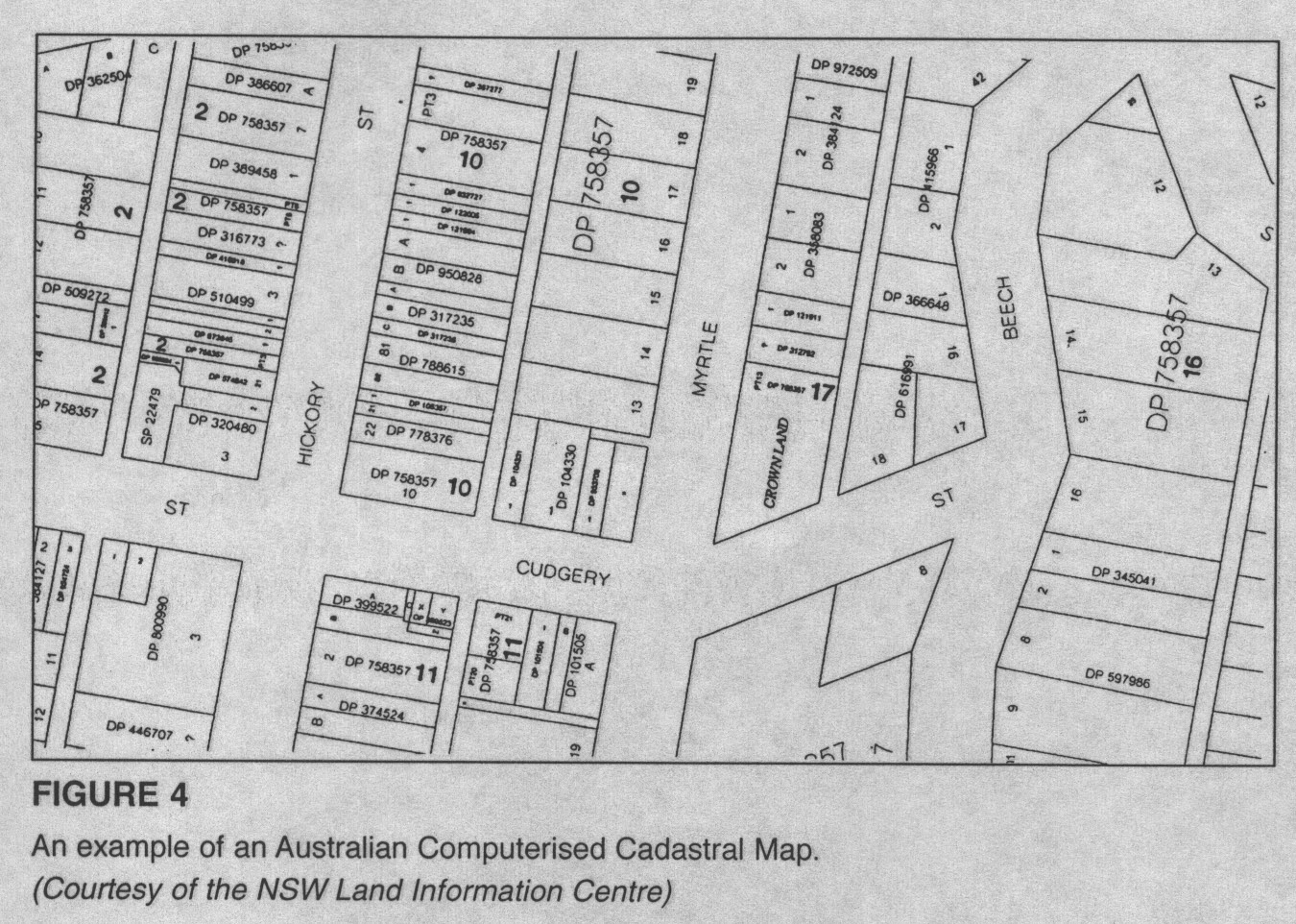
The image above is a cadastral map which is extremely useful for property owners so they know what part of the land is theirs. The map shows the shape and the size of the property of land the landowner owns. Properties across the world are broken down through a measurement of metes and bounds of that areas specific county. In the map above each property is labeled with a number so the piece of land can be identified. The map also provides the shapes of property and the different streets that divide up the area.
No comments:
Post a Comment